September 18, 2019
Update: Tropical Depression Imelda Continues, More Rainfall Expected
What is the danger?
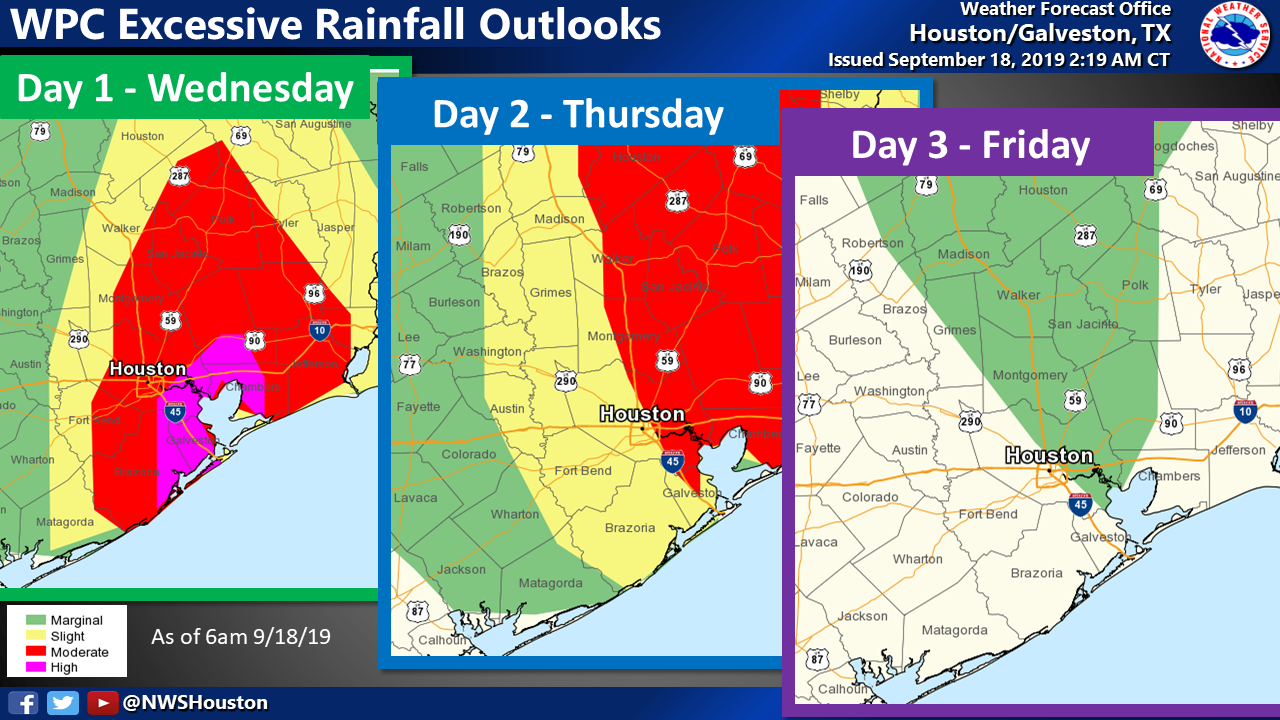
Tropical Storm Imelda has been downgraded to a tropical depression. Widespread rainfall continues today and the
National Weather Service has issued a Flash Flood Watch for Harris County until 7:00 AM Thursday.
According to the
National Hurricane Center (NHC), Imelda is expected to continue moving northward across southeast Texas through Thursday.
According to
Harris County Flood Control District, there have been widespread rainfall amounts of 5 to 6 inches, with isolated amounts of 8 to 9 inches in certain areas. More rainfall is expected across the region this afternoon with rates of 2 to 4 inches, and isolated amounts of 6 inches, possible. Minor street flooding and ponding will occur with continued rainfall.
Residents should closely monitor the forecast and road conditions throughout the day for changes. Visit
ReadyHarris.org for updated list of school, court and transportation closures.
Tropical Storm Jerry formed early this morning in the Atlantic, but currently poses no threat to Texas.
What you should do:
Residents are encouraged to stay updated on the latest road and weather conditions, and be cautious on roadways.
DRIVE SAFELY - Never drive into high water and use extreme caution at underpasses and low-lying areas where water accumulates.
- Always remember to Turn Around, Don’t Drown! DO NOT DRIVE through high water and DO NOT DRIVE AROUND BARRICADES.
- Just two feet of water can sweep your vehicle away.
STAY INFORMED
Depresión Tropical Imelda Continua, Se Esperan Más Precipitaciones
¿Cuáles el peligro?:
La Tormenta Tropical Imelda ha sido degradada a una depresión tropical. Lluvia generalizada continua hoy. El
National Weather Service ha emitido un Alerta de Inundación para el Condado Harris hasta 7:00 AM del Jueves
Según el
National Hurricane Center (NHC), Imelda continuará moviéndose hacia el norte a través del sureste de Texas hasta el Jueves.
El
Harris County Flood Control District, ha reportado 5 a 6 pulgadas de lluvia en cantidades generalizadas con cantidades aisladas de 8 a 9 pulgadas en ciertas áreas. Se esperan más precipitaciones en toda la región esta tarde con mediciones de 2 a 4 pulgadas, y cantidades aisladas de 6 pulgadas posibles. Se producirán inundaciones menores en las calles con lluvias continuas.
Los residentes deben monitorear el pronóstico y las condiciones de la carretera durante el día para detectar cambios. Visite ReadyHarris.org para obtener una lista actualizada de los cierres de escuelas, tribunales y transporte.
La tormenta tropical Jerry se formó esta mañana en el Atlántico, pero no representa una amenaza para Texas.

Lo que debes hacer:
CONDUZCA CON PRECAUCIÓN - Nunca conduzca en lugares inundados y tenga mucho cuidado en los pasos subterráneos y áreas bajas donde se acumula agua.
- ¡Recuerde regrésese y no se ahogue! NO CONDUZCA en aguas altas y NO CONDUZCA ALREDEDOR DE BARRICADAS.
- Tan solo dos pies de agua pueden barrer su vehículo.
MANTENGASE INFORMADO
MESSAGE_ID# 366828861796253