
January 20, 2022
Severe Weather Is Expected in Harris County through Friday
The Harris County Office of Homeland Security & Emergency Management is monitoring a blast of very cold air moving through the area today. The National Weather Service is forecasting temperatures will drop to near freezing across the entire region. Rainfall is also possible. Overnight and into Friday morning, temperatures in Harris County will be in the low 30s with wind chill values in the twenties. The primary risk will come from exposure to temperatures at or below freezing, especially in far north Harris County. Residents should take measures to protect people, plants and pets. Dress in warm, layered clothing if you plan to be outside.
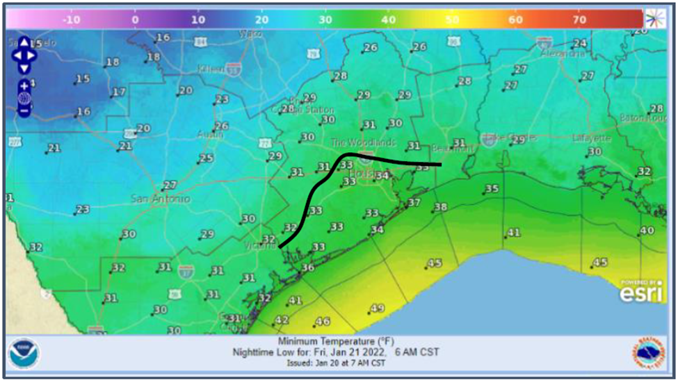
Freezing line tonight shown in black.
Freezing rain, sleet or even snow is unlikely inside Harris County. Ice on bridges and freeway flyovers is possible and residents should monitor road conditions at Houston TranStar Map.
Temperatures will warm to the low 40s by early Friday morning.
For more information on how to prepare and stay safe during a winter weather event, visit ReadyHarris.org.
Stay informed by following HCOHSEM updates online, on social media or by signing up for Ready Harris Alerts.
Se espera clima severo en el Condado Harris hasta el viernes
La Oficina de Seguridad Nacional y Manejo de Emergencias del Condado Harris (HCOHSEM, por sus siglas en inglés) está monitoreando una ráfaga de aire muy frío que se está moviendo en la zona hoy. El Servicio Nacional de Meteorología pronostica que las temperaturas caerán hasta casi el punto de congelacion en toda la región. También existe la posibilidad de lluvia.
Las temperaturas en el Condado Harris estarán en los 30 grados con valores de sensación térmica en los veinte esta noche y durara hasta el viernes por la mañana. El riesgo principal será la temperatura en o cerca del punto de congelación, especialmente en el extremo norte del Condado Harris. Se aconseja a los residentes tomar medidas para proteger a las personas, las plantas y las mascotas. Si necesita salir, manténgase abrigado y vístase en capas.
Lluvia helada, aguanieve o incluso nieve no es probable en el Condado Harris. Existe la posibilidad que haya hielo en puentes y pasos elevados de autopistas. Se recomienda a los residentes monitorear las condiciones de las carreteras en el mapa de Houston TranStar.
Se espera que las temperaturas suban a los 40 grados por la mañana del viernes.
Para obtener más información sobre cómo prepararse y mantenerse seguro durante un evento invernal, visite ReadyHarris.org.
Manténgase informado siguiendo las actualizaciones de HCOHSEM en línea, en las redes sociales o registrándose en Ready Harris Alerts.
MESSAGE_ID# 2403261835379348